Recent searches
Search options


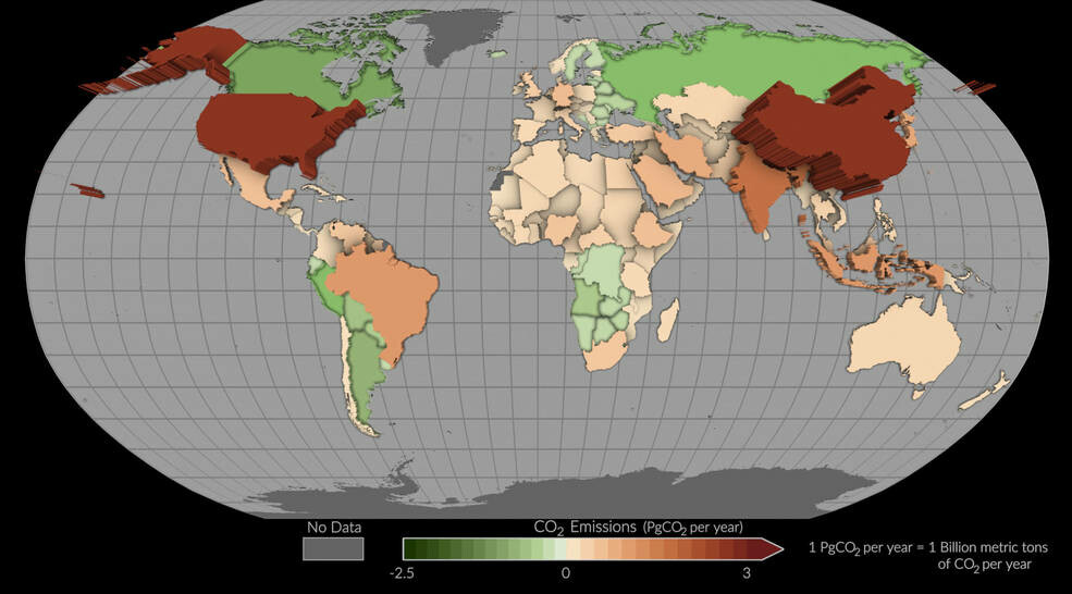
NASA’s OCO-2 satellite helps track carbon dioxide emissions for more than 100 countries.
In this map, countries where more carbon dioxide was removed than emitted appear as green depressions, while countries with higher emissions are tan or red and appear to pop off the page.
#NASAEarth


@StephenRees @nasa probably forest industry. Technically, building wooden buildings is the original carbon capture technology.